top of page

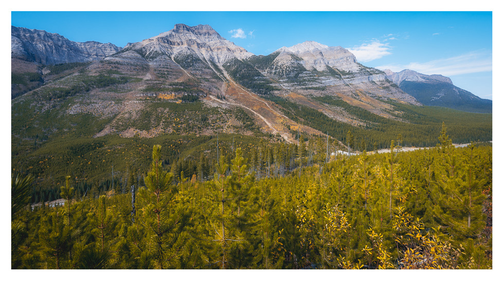
The Columbia Valley was a huge but pleasant surprise. I’m not sure what we expected, but what we found was a gorgeous, sun-filled valley dotted with lakes, wetlands and rivers.


One of the best places to view this bounty is on the Old Coach Trail, which runs between Radium Hot Springs and Dry Gulch, a small community about halfway to Invermere. Originally used in the early 1900s by horse carriages and early automobiles, the trail is nine kilometres long and winds on the bench lands above the Columbia River. Today it’s popular with both mountain bikers and walkers and it’s not hard to see why.


We visited twice — once because we were curious and the second time because we loved it and realized it would be a great place to watch the sunset. And it really was. The warm sun filled the valley with golden light, contrasted against the absolute stillness of the Columbia River. The calm was broken only by the occasional train passing below or chatty mountain bikers ripping by on the trail beside us.


We stayed until the sun was fully down, loathe to miss a moment of the amazing scene before us. When we left we realized we had forgotten to eat the picnic we had packed.


Kootenay National Park is ridiculously attractive. You can’t go five feet without tripping over something to photograph. I couldn’t anyway. Most of the photo subjects are mountains. But the park also has a lot of rivers, creeks and waterfalls. Here are a few we visited:


(Top) Numa Falls — We were lucky to see this because the Numa Falls Day Use Area was closed for most of 2020 for upgrades. One upgrade was a new bridge right above the falls. It gives a great view of the deeply carved, smooth walls of the canyon.


(Above) Vermilion River — The river is a beautiful turquoise, which is odd given its name; seen here it is gentle and welcoming…hard to believe only a few hundred feet from this spot the river narrows and forms Numa Falls. Eventually it joins the Kootenay River, which we’ll see soon.

(Above) Marble Canyon — One of Kootenay National Park's biggest attractions, which was evident by the number of people walking the trail. The trail looks down on Tokumm Creek, which carved the canyon over centuries and flows into the Vermilion River. Getting to the top requires a bit of climbing and crossing bridges at sometimes dizzying heights. My conclusion: I wouldn’t want to fall in.

(Above) Kootenay River — We stopped at a calm, peaceful stretch of Kootenay River near the south end of the park. People put in canoes and kayaks here. We had our canoe, but realized we’d never be able to paddle back upstream if we went in. Instead we took off our shoes and put our feet in the water…and yep, it was frigid.


Our home base in Kootenay National Park was Redstreak Campground. It was a little confusing, since the first thing we were told on entering the park was that the campground was back the other way. The campground is in the park but its entrance is a couple of kilometres before the park gate and is poorly marked. That aside it was a great campground, quiet and filled with trees, trails and wildlife. Much better than some of the RV parking lots passing as campgrounds we had seen earlier.


After exploring the local area (Radium Hot Springs, Invermere) our first order of business was to go deep into the park. How deep? Almost as far as you can go and still be in Kootenay National Park (go farther and you end up in Banff National Park). Our goal was the Stanley Glacier trail.


The Stanley Glacier trail is about 10 kilometres return and is rated moderate. It has some elevation gain but you’re unlikely to notice it while gaping at the scenery. There are the usual wildlife warning signs at the trailhead but the trail was busy enough when we visited that no animal in its right mind would have stuck around to trouble us. (Or to have its photo taken, darn it.)


The reward when you reach the top is an amazing view of the glacier and surrounding mountains. The trail ends where the valley widens; the more adventurous continue up the rocky slopes to the foot of a waterfall, caves and the glacier itself. Some say scrambling over the rocks is easy…others not so much. We were content to go partway into the rock field, set up our chairs and have some lunch before descending.


Even on a cloudy day it’s beautiful. And the highway through the national park is one of the nicest I have driven. I wanted to drive it again just for pleasure. Maybe another day.


The photos I've included with this post are:


* (Top) Sun bursting from behind Stanley Peak

* (Below, Top) Diana on the Stanley Glacier Trail

* (Below, Second) Near the end of the Stanley Glacier Trail (Can you spot the people? And the glacier?)

* (Below, Third) A closer view of Stanley Glacier

* (Below, Fourth) Mt. Whymper towering beautifully near the trailhead


Keep Up To Date with Timid Turtle!

Thanks for subscribing!

© 2025 Timid Turtle Creative

Follow Timid Turtle Creative:

  • Twitter Social Icon
  • Instagram
  • YouTube Social  Icon
  • Facebook Social Icon
bottom of page